A coalition of leading scientists, civil society, governments, tech innovators and WWF have launched BlueCorridors.org.
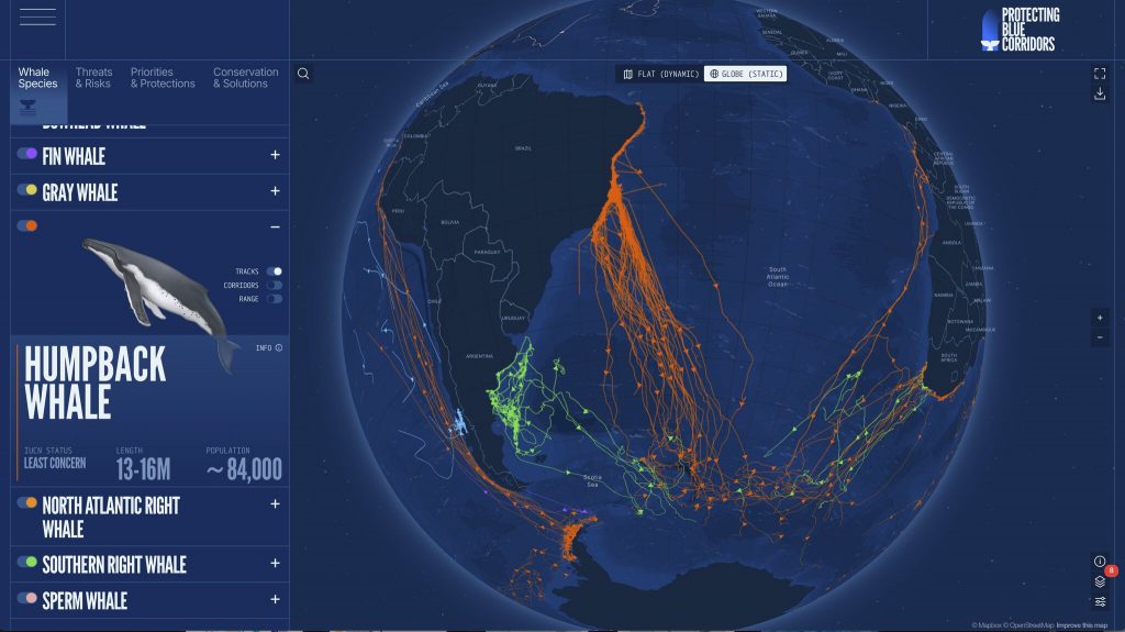
In a major advance for marine conservation, a global coalition of leading scientists, civil society, governments, tech innovators and WWF have launched BlueCorridors.org—a dynamic new platform that brings together three decades of whale tracking data with information on overlapping marine threats and conservation solutions. For the first time, the migratory “blue corridors” used by great whales are now digitally mapped and made publicly accessible to inform science, policy, and ocean protection efforts worldwide.
Launched ahead of World Oceans Day (8 June) and the UN Ocean Conference in Nice, France (9-13 June), the platform advances international goals to protect 30% of the ocean by 2030, as set out in the Kunming-Montreal Global Biodiversity Framework, underscores the importance of ratifying the UN High Seas Treaty (BBNJ Agreement), and contributes to the ambitions of the UN Decade of Ocean Science. The Blue Corridors platform not only emphasizes the need for collaborative action to achieve all these global goals and policy frameworks – and especially the 30×30 goal, but also provides practical, actionable guidance on how to achieve that.
The platform visualizes satellite tracking data from over 50 global research groups, including Oregon State University, the University of California Santa Cruz, the University of Southampton, and many others. These maps trace the migratory superhighways that connect whales to critical breeding, feeding, and social habitats across ocean basins—routes essential not only for whale survival but for the health of marine ecosystems.
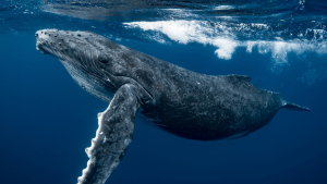
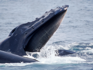
But these lifelines are under increasing threat. Despite decades of conservation work, seven of the 14 great whale species remain endangered or vulnerable, facing growing risks from ship strikes, entanglement in fishing gear, underwater noise, plastic pollution, and accelerating climate impacts.
BlueCorridors.org offers an urgent and innovative solution: a powerful, interactive tool that combines migration data with layers of marine threats and conservation priorities to help guide protection efforts across national borders and disciplines.
Blue corridors are more than migration routes—they’re lifelines for the ocean’s giants and the ecosystems they support. This platform transforms decades of science into a tool for action—showing when, where, and how to protect whales in a rapidly changing ocean.
Chris Johnson, Global Lead for WWF’s Protecting Whales and Dolphins Initiative
Key features of the platform include:
- Whale movement maps by species and time of year that can be produced and shared;
- Conservation data from partners such as the IUCN Marine Mammal Taskforce’s Important Marine Mammal Areas (IMMAs), and other ecologically important zones, to inform future marine protected areas design and planning;
- Overlapping threats, including shipping routes, fishing effort, and climate change layers;
- Case studies, highlighting hotspots where whales are most vulnerable and which solutions governments can action.
BlueCorridors.org builds on the collaborative “Protecting Blue Corridors” report (2022), which mapped global whale migration for the first time and outlined targeted regional conservation actions—from the Eastern Pacific and Mediterranean to the Southern Ocean. The new, digital platform meets the growing need for open-access, science-based marine connectivity tools, with peer-reviewed publications on its methodology and collaborative design to follow later in 2025.
This is the future of conservation—open, collaborative, and grounded in science. By linking threats with solutions, this platform supports smarter, more coordinated marine planning that spans sectors and borders.
Dr. Ryan Reisinger, co-lead of the initiative from the University of Southampton